Survey. Measure. Compare.
Precision construction surveying on an interactive 3D globe. Import drone data, overlay design files, take measurements with centimetre accuracy, and verify conformance — all in your browser.
Free during beta. Part of the Pasco Cloud ecosystem.
Everything You Need to Survey a Site
From drone flights to design conformance — a complete surveying and measurement platform.
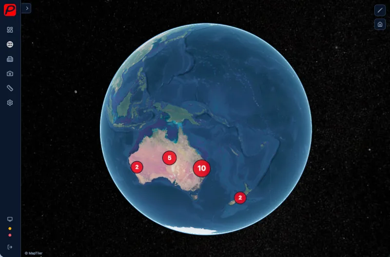
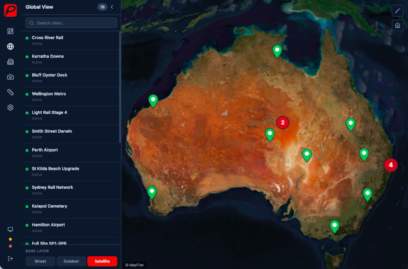
3D Globe & Site Management
All your construction sites on an interactive CesiumJS 3D globe. Navigate, search, and drill into site details from anywhere.
- Interactive CesiumJS 3D globe with all your sites
- Colour-coded pins by status, clustering at low zoom
- Fly-to navigation, side panel search
- Three base maps: Street, Outdoor/Topo, Satellite
- Link sites to Pasco Cloud projects
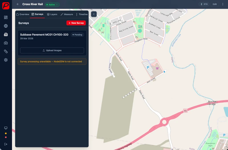
Drone Surveys & Data Import
Process drone imagery on-server or import pre-processed outputs from your preferred photogrammetry platform.
- Upload drone images for NodeODM photogrammetry processing
- Or import pre-processed data from Pix4D, DroneDeploy, Agisoft
- Orthophoto, DEM, and point cloud support
- Tile-based map overlay with opacity controls
- Survey timeline and comparison
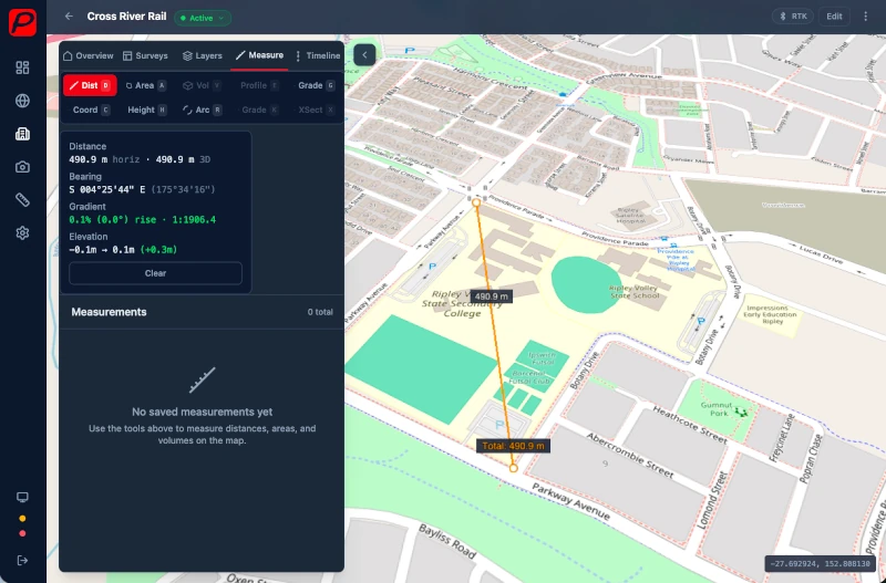
10 Precision Measurement Tools
Every measurement tool a construction surveyor needs, built directly into the 3D map.
- Distance (3D + bearing + gradient per segment)
- Area, Volume (with stockpile mode)
- Elevation Profile, Gradient/Slope
- Coordinate Readout (WGS84, DMS, MGA2020, NZTM2000)
- Height, Arc/Curve
- Grade Check, Cross-Section
- All measurements saveable with categories, notes, and photos
Design Comparison Screenshot
Design Surface Overlay & Comparison
Overlay design files on your survey data and run conformance checks to verify construction is on spec.
- Import DXF from AutoCAD, Civil3D, 12d
- Import KML/KMZ from Google Earth with style preservation
- Per-layer visibility, colour, and opacity controls
- Compare survey against design: cut/fill volume, grade check, cross-section, heat map
- Colour-coded pass/marginal/fail conformance results
Road & Rail Alignments
Import alignment data with full support for straights, curves, and spiral transitions. Inspect conformance at any chainage.
- LandXML alignment import (straights, curves, spiral transitions)
- DXF polyline alignment support
- Chainage markers at configurable intervals
- Cross-sections at any chainage with survey vs design profiles
- Conformance checking with configurable tolerances
Alignment Cross-Section Screenshot
RTK Mobile Screenshot
RTK GNSS Integration
Connect high-precision GNSS receivers for centimetre-accurate point capture directly from the field.
- Connect RTK receivers via Bluetooth (mobile) or Web Bluetooth (Chrome)
- NTRIP correction streaming for centimetre accuracy
- Live position on the map with accuracy display
- Capture survey points from the field
- Pre-configured QGPSnet (Queensland) support
Measurements & Export
A complete measurement register with powerful export options for every workflow.
Measurement Register
Cross-site register with search, filter by type, and category management. View all measurements across your sites in one place.
Manual Calculator
Point-to-point, radial, and traverse calculators. CSV coordinate import and coordinate converter between systems.
Export Options
PDF reports, CSV with MGA2020/NZTM2000 coordinates, and DXF for AutoCAD. Full Australia (zones 49-56) and New Zealand support.
Survey from the Field
The Pasco SiteView mobile app brings precision surveying to your phone. Capture points with GPS or RTK Bluetooth, take distance measurements, and sync everything back to the web.
- Point capture with phone GPS or RTK Bluetooth
- Offline mode with map caching and data sync
- Distance measurement between captured points
- Available on Android (iOS coming soon)
Mobile App Screenshot
Under the Hood
For the technically minded — what powers Pasco SiteView.
Built on CesiumJS (3D globe), Leaflet (2D forms), GDAL (raster operations)
Supports DXF, KML, KMZ, LandXML, GeoTIFF, LAS/LAZ file formats
MGA2020 (GDA2020) zones 49-56 + NZTM2000 coordinate systems
Self-hosted — your data stays on your infrastructure
Part of the Pasco Cloud ecosystem — shared accounts, project linking
NodeODM photogrammetry processing with async tiling pipeline